August 21, 2017
Summary: Temperatures Sunday afternoon were generally down a few degrees due to a deep marine layer along the coast. The marine layer remains deep this morning at just under 3,000 feet deep. The modified sea breeze is surging through the Delta where winds at Fairfield are sustained at 23 MPH, gusting to 31. Through Pacheco Pass, winds are sustained at just below 20 MPH. This will result in temperatures through Wednesday being at or marginally below average. This is all being brought about by a very weak upper low off the southern California coast. The other element of this system is the counterclockwise circulation around the low has picked up monsoon moisture from Arizona.
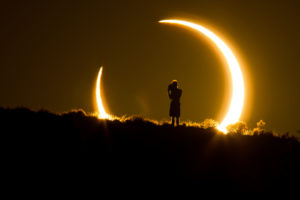
The winds aloft above central California currently are out of the southeast. It appears the deepest tropical moisture will sweep from east to west from roughly Madera County northward, leaving most of the growing area under mostly clear skies for today’s partial eclipse.
Model information shows this band of moisture moving to the north later Tuesday through Wednesday, keeping central California dry with the exception of the Sierra Nevada which will see afternoon and evening thunderstorms. It’s possible a few isolated cells could develop over the Kern County mountains and deserts, but unlike previous projections, only isolated activity is expected, if at all.
We will begin a warming trend Thursday which, in all likelihood, will last through at least the middle of next week. A strong ridge is projected to build over the western U.S., moving temperatures to near 100 Thursday and above the century mark Friday. over the weekend and through at least the middle of next week, temperatures at most locations will range between 100 and 105 and possibly hotter in the traditional hot spots.
Forecast: Mostly clear from roughly Fresno County southward with occasional cloudiness through Tuesday night. Mostly clear to occasionally partly cloudy in Madera County. Mostly clear Wednesday and on through Monday and becoming hot Friday through Monday.
Short Term:
| Madera 93/63/94/66/97 | Reedley 96/66/97/66/98 | Dinuba 95/67/97/66/98 | |
| Porterville 96/66/97/66/99 | Lindsay 98/64/97/65/98 | Delano 97/68/97/68/99 | |
| Bakersfield 96/72/97/73/97 | Arvin 98/69/98/69/99 | Taft 97/71/97/72/98 | |
| Lamont 98/68/98/69/99 | Pixley 96/67/97/67/98 | Tulare 95/66/96/66/97 | |
| Woodlake 96/65/97/66/97 | Hanford 96/66/97/66/97 | Orosi 95/65/96/65/97 | |
Seven Day Forecast:
| Thursday
Mostly clear 67/99 |
Friday
Mostly clear 68/101 |
Saturday
Mostly clear 69/103 |
Sunday
Mostly clear 70/104 |
Monday
Mostly clear 69/103 |
Two Week Outlook: August 28 through September 3: Upper level high pressure will again dominate the pattern during this period. This model is also indicating the monsoon will work its way further west into at least southern California. There would appear to be a better than even chance for thunderstorm activity over the Sierra Nevada, but no precipitation is expected over the valley floor.
September: This model shows upper level high pressure more dominant over the western U.S. There’s no clear indicator of above or below average rainfall as we move into the fall season. With that in mind, we’ll call for near average precipitation for the month.
September, October, November: It appears temperatures overall will rise to above average values for the bulk of this time frame. Upper level high pressure is also more dominant with precipitation, believe it or not, predicted to be somewhat near average.
Winds: Winds will be generally less than 15 MPH through Thursday and mainly out of the northwest afternoons and evenings.
Rain: Expect dry weather indefinitely.
Afternoon Dew Points Today: Upper 50s to the lower 60s. Kern: Mid to upper 50s
Relative Humidity Forecast: Hanford, 30%/80% Bakersfield, 25%/60%
Actual Humidity August 17, 2017: Delano, 79%/29%, Porterville, 91%30%
Percentage of Sunshine Today/Tomorrow: Visalia: Today 70% tomorrow 90%, Bakersfield: Today 80% tomorrow 80%.
ET Rates Over the Past Seven Days August 17, 2017: Stratford 1.89, Parlier 1.52, Blackwell 2.02, Lindcove 1.66, Arvin 2.04, Orange Cove 1.93, Porterville 1.60, Delano 1.73, Madera Two 1.59. Courtesy University of California *=estimate, NA=not available.
Seven Day Soil Temperatures: Stratford 75, Parlier 83, Blackwell 79, Lindcove 78, Arvin NA, Orange Cove 82, Porterville 84, Delano 83, Madera Two 81
Mean Temperatures for August Month So Far: 82.5. +3.6
Record Temperatures: 112/52. Average Temperatures: 97/64
Cooling Degree Days This Season: 1536, +380 Courtesy of the NWS
Precipitation: Seasonal total/average/above or below average:
Since August 17, 2017, Fresno: 17.20 season / +5.88 or +5.88, Month to Date: T
Since August 17, 2017, Bakersfield: 7.88, or 1.46, Month to Date: T, Water year season is from October 1st through September.
Chilling Hours November 1st Through February 28: Orange Cove, Parlier, Arvin, Shafter, , Stratford, Madera two, Alpaugh, Delano, Lindcove, Porterville, Hours at 45 or below 45.
Sunrise: 6:20 am Sunset: 7:45 Hours of Daylight: 13:27
Yesterday’s Weather
MCE : Merced 153 : DH1700 / 92 / 62 / 0.00 /
MAE : Madera 253 : DH1700 / 93 / 63 / 0.00 /
FAT : Fresno Airport 333 : DH1700 / 96 / 68 / 0.00 /
HJO : Hanford Airport 242 : DH1700 / 97 / 67 / 0.00 /
NLC : Lemoore Naval AS 234 : DH1700 / 99 / 68 / 0.00 /
BFL : Bakersfield Airport 496 : DH1700 / 98 / 74 / 0.00 /
VIS : Visalia Airport 292 : DH1700 / 94 / 67 / 0.00 /
ATEC1 : Avenal 787 : DH1653 / 96 / 68 / 0.00 /
PTV : Porterville Airport 442 : DH1700 / 96 / 69 / 0.00 /
TFTC1 : Taft 759 : DH1656 / 97 / 72 / 0.00 /
Rainfall:
To date Last year Average Annual ave
STOCKTON 0.00 21.78 158 16.69 121 13.76 14.06
MODESTO 0.00 16.93 132 15.61 122 12.84 13.11
MERCED 0.00 16.03 131 14.66 120 12.20 12.50
MADERA 0.00 14.18 121 12.96 110 11.75 12.02
FRESNO 0.00 17.20 152 14.29 126 11.32 11.50
HANFORD 0.00 11.05 112 8.26 83 9.91 10.10
BAKERSFIELD 0.00 7.82 123 5.43 85 6.37 6.47
BISHOP T 9.18 187 3.88 79 4.92 5.18
SALINAS 0.00 16.45 130 13.47 106 12.65 12.83
PASO ROBLES 0.00 16.14 129 8.06 65 12.49 12.78
SANTA MARIA 0.00 18.44 134 9.00 65 13.80 13.95
Rainfall season from October 1st through September 30th
Next Report: Tuesday, August 22