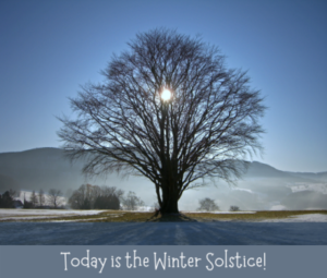
 Today is the winter solstice. We are blessed with 9 hours and 38 minutes of daylight. Just in case you’re counting, winter begins at 9:00 this morning. The weather has timed it perfectly as all locations in the valley yesterday saw daytime highs that were the coldest in a few years with highs only in the lower 40s. that protective layer of fog and low clouds has insulated the valley so that lows this morning are only a degree or two colder than yesterday’s highs.
The pattern is changing, though, as a large area of low pressure remains roughly 500 miles off the northern California coast. Subtropical moisture is feeding underneath the low into southern California where sprinkles are occurring. Rain has spread as far south as Ukiah along the northern California coast. Precipitation will spread down to a Monterey/Merced line tonight, spreading down the remainder of the valley Wednesday. This is a strong winter storm so no doubt a rain shadow will develop along the west side and in Kern County. A new low will drop out of the Gulf of Alaska and into California Christmas Eve. Snow levels, which are currently above 8,000 feet will plummet down to 3,000 to 4,000 feet at that time.
Models continue to show the eastern Pacific high way out over the eastern Pacific while a broad trough of low pressure extends from the Gulf of Alaska southward into California. Waves of low pressure will move through the trough and into California for the next week to possibly ten days. The result will be periods of rain interspersed with periods of dry weather. Temperatures will warm possibly as early as this afternoon if the low clouds lift out of here. Warmer locations tomorrow will see afternoon highs pushing the 60 degree mark.
Forecast: Low overcast and fog today. Clearing by late afternoon with mostly cloudy skies tonight. Periods of rain tonight through Wednesday. Periods of rain Wednesday night through next Tuesday.
Short Term:
Highs this afternoon will warm into the mid to upper 50s if the fog clears in time. Lows tonight will be in the upper 30s to the low 40s. highs Wednesday will warm into the mid 50s to near 60. Lows Wednesday night will only cool into the upper 40s to the lower 50s. Highs Thursday will warm into the upper 50s to the lower 60s.
Seven Day Forecast:
| Christmas Eve
Periods of rain 47/58 |
Christmas Day
Periods of rain 41/53 |
Sunday
Periods of rain 40/52 |
Monday
Periods of rain 37/51 |
Tuesday
Periods of rain 37/50 |
Two Week Outlook: December 28 through January 3: This model is reverting back to a colder and wet weather pattern so the chance of precipitation will remain high during this period with below average temperatures continuing.
December, January, February: If this model is to be believed at all, temperatures will be marginally above average over central California. This model also depicts the main storm track continuing into the Pacific Northwest with somewhat below average precipitation over the southern 2/3 o4f California.
Wind Discussion: Winds will be out of the southeast later today at 5 to 10 MPH. Winds tonight through Friday will be mainly out of the southeast at 8 to 15 MPH with gusts as high as 25 MPH possible.
Rain: It’ll be Wednesday before precipitation spreads in from the west as waves of low pressure move on shore. Expect periods of rain beginning Wednesday and lasting for at least the next week and possibly longer. Using Porterville as a base, blended models are spitting out a number of 2.92 inches of rain over the next week. This would apply to the rest of the east side, as well. Along the west side, expect anywhere from .25 to .33. Over the valley portion of Kern County, upwards to .25 to ..50 is anticipated. Models going out through the first few days in January are indicating the storm door will remain open for chances of rain at times and low snow levels.
Frost: All locations will be above freezing tonight and each night through the Christmas weekend. On Friday and Saturday, the general environment will turn colder as systems continue to move out of the Gulf of Alaska. I don’t look for any frost at this time, but any night with several hours of clear skies will see temperatures in the lower 30s. So far, there’s still no freeze pattern on the horizon. Looks like we’ll move through December unscathed.
Next report: December 21 PM